How to Reach Munsiyari
Munsiyari is well connected with most of the important towns and cities of Uttarakhand. Getting there guide below provides detailed information about how to reach Munsiyari by Road, Train or Flight.
Munsiyari Location
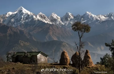
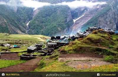
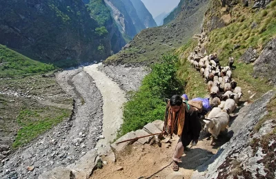
Munsiyari lies on the entrance of Johar valley and falls en route the ancient trade route between Tibet. Munsiyari is a picturesque valley and is fast becoming a tourist attraction. It is 135 Km from Pithoragarh at an elevation of 2298 meters and is snuggled in the folds of snow-clad mountains. Munsiyari is popular with high altitude trekkers and adventure enthusiasts as this place are the base of Milam, Ralam and Namik Glaciers.
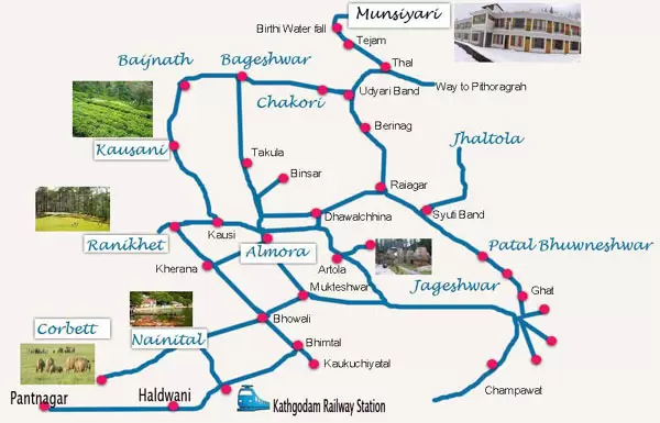
(Location of Munsiyari on Uttarakhand Map with Important Tourist Destinations in Kumaon Region)
How to reach Munsiyari
By Road: Munsiyari is well connected by motorable roads with major destinations of Uttarakhand and northern India. Buses from ISBT Anand Vihar are available to Champawat, Almora, Tanakpur, Haldwani and many other destinations from where you can easily hire a local cab to reach Munsiyari. Taxis and buses are easily available to Munsiyari from major destinations of Kumaon region.
Munsiyari is a very long drive from Delhi and a break journey at Vijaypur, Chaukori or Almora is advisable. If you are traveling by public transport, you may take a bus from Anand Vihar ISBT to Almora and then another bus to Munsiyari. One can also take a bus from Pithoragarh, which is 135 km from Munsiyari.
From Delhi (By Road)
Route 1: Delhi - Hapur - Gajrola - Moradabad bypass - Rampur - Haldwani - Kathgodam - Bhimtal - Bhowali - Khairna - Almora - Chitai Temple - Barechina- Dhaulchina - Sheraghat - Udiyari Bend - Thal - Birthi Fall - Kalamuni Top - Munsiyari.
Route 2: Delhi - Hapur - Gajrola - Moradabad bypass - Kashipur - Kaladhungi - Nainital - Bhowali - Khairna - Almora - Chitai Temple - Barechina- Dhaulchina - Sheraghat - Udiyari Bend - Thal - Birthi Fall - Kalamuni Top - Munsiyari.
Route 3: Delhi - Hapur - Gajrola - Moradabad bypass - Kashipur - Kaladhungi - Nainital - Bhowali - Khairna - Almora - Kosi - Someshwar - Kausani - Baijnath - Garur - Bageshwar - Vijaypur - Chaukori - Udiyari Bend - Thal - Birthi Fall - Kalamuni Top - Munsiyari.
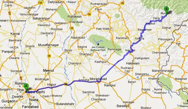
(Google Maps: Delhi to Munsiyari road route)
By Rail: The nearest railheads to Munsiyari are Kathgodam and Tanakpur. The distance from Tanakpur Railway station to Munsiyari is 286 kms, and Kathgodam Railway station is situated at a distance of 275 kms from Munsiyari. Taxis and buses are easily available from Tanakpur and Kathgodam to Almora, Pithoragarh, Bageshwar and Munsiyari. Tanakpur and Kathgodam are well connected by railway networks with major destinations of India.
By Air: The nearest airport to Munsiyari is Pantnagar Airport. Pantnagar airport is situated 249 kms from Munsiyari in the Nainital district of Uttarakhand state. Taxis are available from Pantnagar Airport to Pithoragarh, Almora, Bageshwar, and Munsiyari. Pantnagar is connected to Delhi four round trips flight per week and it is well connected by metalled road with Munsiyari.
The nearest International airport is in New Delhi around 600 kms from Munsiyari. Naini Saini Airport is situated in Pithoragarh but flights to Naini Saini are only available from Dehradun.
Latest Update on Haldwani - Munsiyari Helicopter Service
Under the UDAAN Scheme, Uttarakhand Government has started Helicopter Services from Haldwani to Munsiyari from 22 Feb 2024. Heli Services from Haldwani will be available from Gaulapar Helipad to Munsiyari. A seven seater helicopter will operated by Air Heritage fly 2 times a day from Haldwani to Munsiyari. The ticket price for helicopter service from Haldwani will be INR 3500 for Munsiyari.

