Borasu Pass - Last valley of Uttarakhand
Borasu Pass is located near the border to Uttarakhand and Himachal Pradesh. The pass is open to the public only for a couple of months before the rainy season and a few months before the winter shrouds the region under heavy snow.
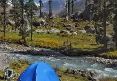
In order to reach Borasu Pass one needs to trek 3-4 days from the Har Ki Dun valley and Borasu Glacier. Trekking in the north direction, one reached Morinda Gad or Tal which is just 3 kms from Har Ki Dun. After continuing on the path for further 5 kms along the widened trekking trails, one reaches the Baspa valley. Doaria camping grounds are perfect to spend overnight.
Why you should go for Borasu pass trek
- The Borasu Pass Trek is a great way to explore the cultures of the Himalayas of Garhwal and Kinnaur both. It will not only take you on a journey of the mind-boggling topography of the Himalayas but also amongst the varied wildlife of Himalayas.
- You will get to see a large variety of mammals and birds such as Wild boar, Indian Crested Porcupine, Yellow-throated marten, Koklass Pheasant, Himalayan Woodpecker, etc.
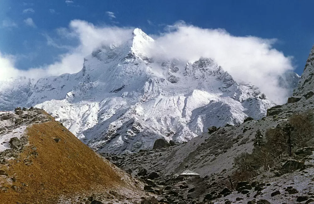
- You will also see the high altitude mountain peaks like Kalanag, Swargarohini I, II, III and some lower peaks like Har Ki Dun, Hata peak, etc. The jewel blue rivers that flow in this area are the Tons, Yamuna, Supin and Baspa river.
Suggested Itinerary of The Borasu Pass Trek
Day 1: Dehradun to Sankri (1920m)
Distance: 190km, 7 hrs drive
Begin your journey from Dehradun till Sankri, travel via bus or taxi according to your trekking package. Stay in Sankri Village in Meraki Sankri Homestay or similar.
Day 2: Sankri to Seema (2560m) via Taluka (1800m)
Distance: 1-hour drive, 5 to 6 hrs hike, 14km
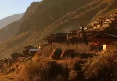
Reach at Taluka from Sankri, the trek begins from Taluka. With the Supin river flowing beside, the walk is quiet pleasant. The path will cross over the Supin river, keep walking through the village of Gangad and gradually the village of Osla will appear. The Seema village is tiny settlement opposite the river from Osla.
Day 3: Seema/Osla to Har Ki Dun (3510m)
Distance: 4 to 5 hours hike, 10km
From Osla the trail gradually gets higher, the ascending path climbs high above the confluence Supin river from the Ruinsara Valley. The Har Ki Dun appears it is located in the midst of two valleys- one originating from the Jaundhar Glacier and other from beyond Hata glacier.
Day 4: Har Ki Dun to Ratha Tho (4200m)
Distance: 4 to 5 hours hike, 5 km
While trekking to the Ratha Tho you will cross the Marinda Tal, a small lake. The path ahead is a bit over the boulders, but the snow-clad peaks and panoramic view makes the walk worth every step.
Day 5: Ratha Tho to Borasu Pass base camp (Upper Lamjung) (4900m)
Distance: 3 to 4 hours hike, 4km
This path is moreover boulders and is covered with snow on most of the areas. The campsites on Upper Lamjung are usually covered with snow all over. The climb, however, opens up to an ecstatic view of the valley left behind.
Day 6: Borasu Pass Base Camp (Upper Lamjung) to Bonga (4000m) via Borasu Pass(5360m)
Distance-As you keep moving higher up the scenery keeps getting wider and better. The cradle shape Borasu Pass appears after crossing two boulders with a final ascent over these boulders. Descending towards the Himachal side of the pass into the large glacier over the initial slope, the trek is further along a tributary of Baspa River, you may find many shepherds along the way.
Day 7: Bonga to Chitkul (3430m)
Distance: 8 hrs hike, 15km
A long trek of 8 hour with an easy walk through flower fields and forest. Stay overnight in Chitkul Village. The trek ends here. From here you can have public or private transport from Chitkul or Sangla to Sankri.
Borasu pass is also known as Barasu pass, Borasu expedition, Buru Su trek.
Borasu Pass Weather
Check out the Borasu Pass weather report for April
Borasu Pass Weather in April
The minimun and maximum temperature in April in Borasu Pass is -5°C and 5°C respectively. The weather is generally chances of snowfall in April and you would feel chilling cold throughout the day. Heavy Woolen clothes are recommended for Borasu Pass in April.
What is Borasu Pass famous for?
Borasu Pass is famous among tourist as Trekking, Expedition, High Altitude Trek, Camping, Garhwal Trekking, High Altitude Pass.
Borasu Pass is recommended destination for Foreigners, Groups.
Borasu Pass is popular destination for following activities/ interests - Adventure, High Altitude Mountain Pass, Trekking.
